
Academic Staff

Oct. 28, 2026, 1:22 a.m.
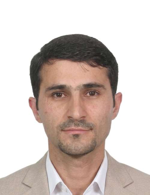
Sarhat Mustafa Adam (PhD)
Assistant Professor
Assistant Professor in Engineering Surveying and Space Geodesy

Civil Engineering
College of Engineering
University of Duhok

  • Ph.D. in Engineering Surveying and Space Geodesy, NGI, University of Nottingham, Nottingham, United Kingdom, 2011–2015.
  • M.Sc. in Engineering Surveying and Geodesy, IESSG, University of Nottingham, Nottingham, United Kingdom, 2008–2009.
  • B.Sc. in Civil Engineering, College of Engineering, Department of Civil Engineering, University of Duhok, Duhok, KRG, Iraq, 1998–2002.

My academic career has focused on undergraduate, postgraduate, life long learning and professional education. My conception has always been to sustain an apparent bond between my teaching and technological/scientific research. This allows education from my personal cutting edge research knowledge and excites interest and passion for the subject. Over my career, I have also undertaken a wide range of academic roles including head of TQA departmental for the college of Engineering, and the Director of TQA directorate of the University of Duhok.

Research

  1. Zaya, M. A., Abdulrahman, F. H., & Adam, S. M. (2026). Strain and deflection assessment of SFRC using digital image correlation.
  2. Abdulrahman, F. H., Adam, S. M., & Zaia, Y. Y. (2025). Assessing the accuracy of a network of GPS passive stations in Duhok city.
  3. Zaia, Y. Y., Adam, S. M., & Abdulrahman, F. H. (2025). Improving building energy performance based on building information modelling approach. International Journal of Masonry Research and Innovation, 10(6), 523–541.
  4. Abdulrahman, F. H., & Adam, S. M. (2024). Investigation of the UAV capability for measuring building's cracks dimensions. Passer Journal of Basic and Applied Sciences, 6(Special Issue), 14–27.
  5. Zaia, Y. Y., Adam, S. M., & Abdulrahman, F. H. (2023). Investigating BIM level in Iraqi construction industry. Ain Shams Engineering Journal, 14(3), Article 101881.
  6. Zaya, M. A., Adam, S. M., & Abdulrahman, F. H. (2023). Application of digital image correlation method in materials–testing and measurements: A review. Journal of Duhok University, 26(2), 145–167.
  7. Salim, S. A. M., & Adam, S. M. (2021). Investigating the vertical displacement of Duhok embankment Dam: A 31-Years case study. Journal of Engineering Research, 9, 1–16.
  8. Abdulrahman, F., & Adam, S. (2020). The assessment of OPUS-Static in limited CORS area based on session duration. In 2020 6th International Engineering Conference "Sustainable Technology and Development" (IEC).
  9. Abdulrahman, F. H., Foroughi, S., & Adam, S. M. (2020). A comparison between interpolation methods for more accurate elevation surface using GNSS and GIS. Journal of Duhok University, 23, 342–351.
  10. Adam, S. M., Kattan, R., & Shukri, A. H. (2019). Highway tracking and mapping using mobile GPS techniques. Engineering Archive.
  11. Adam, S. M., & Heeto, A. F. (2018). The use of semi-automated method for assessing the horizontal positional accuracy of Google Earth imagery. Academic Journal of Nawroz University, 7(4), 173.
  12. Adam, S. M. (2017). The use of online and offline processing tools to improve the precision of a GPS passive station. Journal of Duhok University (Pure and Engineering Sciences), 20(1), 335–346.
  13. Zaia, Y. Y., Adam, S. M., & Gilyana, S. M. (2017). A comparison of RTK-GPS vertical component with precise digital level for estimating volumes. Journal of Duhok University, 20(1), 374–380.
  14. Adam, S. M. (2015). Digital images for road surface monitoring [Doctoral dissertation, University of Nottingham].
  15. Farhan, A. H., Dawson, A. R., Thom, N. H., Adam, S., & Smith, M. J. (2015). Flexural characteristics of rubberized cement-stabilized crushed aggregate for pavement structure. Materials & Design, 88, 897–905.
  16. Fendi, K. G., Adam, S. M., Kokkas, N., & Smith, M. (2014). An approach to produce a GIS database for road surface monitoring. APCBEE Procedia, 9, 235–240.

Assistant Professor Adam's research affairs and expertise are concerned with the development and applications of satellite navigation and positioning systems, such as GPS. He has some research background in the navigation, engineering and monitoring applications of these systems. He also has an interest in Engineering Surveying, Photogrammetry and Remote Measurement.