
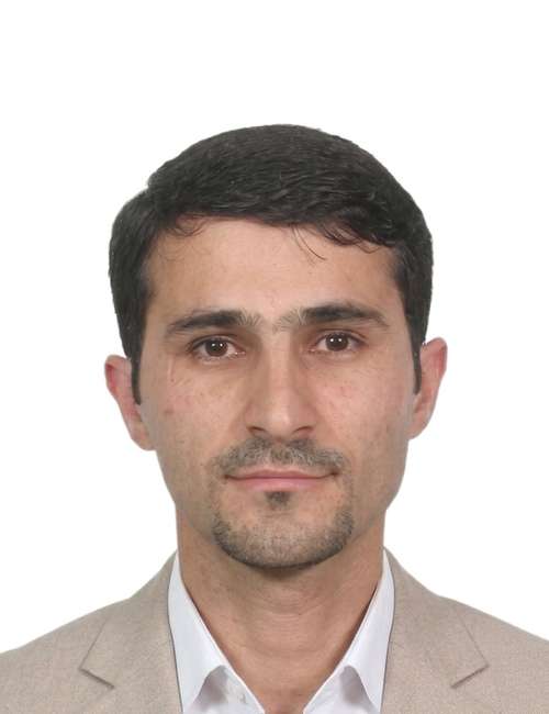
الكادر التدريسي

أكتوبر 28, 2026, 1:22 ص
سرهات مصطفى ادم (دكتوراه)
استاذ مساعد
أستاذ مساعد في هندسة المساحة والجيوديسيا الفضائية

الهندسة المدنية
کلیة الهندسة
جامعة دهوك

  • الدكتوراه (Ph.D.) في المساحة الهندسية والجيوديسيا الفضائية – معهد نوتنغهام للجيوديسيا والجيوماتكس (NGI)، جامعة نوتنغهام، نوتنغهام، المملكة المتحدة، 2011–2015.
  • الماجستير (M.Sc.) في المساحة الهندسية والجيوديسيا – معهد المساحة الهندسية والجيوديسيا الفضائية (IESSG)، جامعة نوتنغهام، نوتنغهام، المملكة المتحدة، 2008–2009.
  • البكالوريوس (B.Sc.) في الهندسة المدنية – كلية الهندسة، قسم الهندسة المدنية، جامعة دهوك، دهوك، إقليم كردستان، العراق، 1998–2002.

تركزت مسيرتي الأكاديمية على تعليم مرحلة البكالوريوس والدراسات العليا والتعلم مدى الحياة والتعليم المهني. وكانت رؤيتي دوماً قائمة على إقامة رابط وثيق وملموس بين التدريس والبحوث التكنولوجية والعلمية؛ مما يتيح التعليم المستمد من معرفتي البحثية المتقدمة والحديثة، ويثير الاهتمام والشغف بالمادة الدراسية. وعلى مدار مسيرتي المهنية، توليت أيضاً مجموعة واسعة من الأدوار الأكاديمية، بما في ذلك رئيس لجنة ضمان جودة التعليم على مستوى القسم في كلية الهندسة، ومنصب مدير مديرية ضمان الجودة في جامعة دهوك.

البحث العلمي

  1. Zaya, M. A., Abdulrahman, F. H., & Adam, S. M. (2026). Strain and deflection assessment of SFRC using digital image correlation.
  2. Abdulrahman, F. H., Adam, S. M., & Zaia, Y. Y. (2025). Assessing the accuracy of a network of GPS passive stations in Duhok city.
  3. Zaia, Y. Y., Adam, S. M., & Abdulrahman, F. H. (2025). Improving building energy performance based on building information modelling approach. International Journal of Masonry Research and Innovation, 10(6), 523–541.
  4. Abdulrahman, F. H., & Adam, S. M. (2024). Investigation of the UAV capability for measuring building's cracks dimensions. Passer Journal of Basic and Applied Sciences, 6(Special Issue), 14–27.
  5. Zaia, Y. Y., Adam, S. M., & Abdulrahman, F. H. (2023). Investigating BIM level in Iraqi construction industry. Ain Shams Engineering Journal, 14(3), Article 101881.
  6. Zaya, M. A., Adam, S. M., & Abdulrahman, F. H. (2023). Application of digital image correlation method in materials–testing and measurements: A review. Journal of Duhok University, 26(2), 145–167.
  7. Salim, S. A. M., & Adam, S. M. (2021). Investigating the vertical displacement of Duhok embankment Dam: A 31-Years case study. Journal of Engineering Research, 9, 1–16.
  8. Abdulrahman, F., & Adam, S. (2020). The assessment of OPUS-Static in limited CORS area based on session duration. In 2020 6th International Engineering Conference "Sustainable Technology and Development" (IEC).
  9. Abdulrahman, F. H., Foroughi, S., & Adam, S. M. (2020). A comparison between interpolation methods for more accurate elevation surface using GNSS and GIS. Journal of Duhok University, 23, 342–351.
  10. Adam, S. M., Kattan, R., & Shukri, A. H. (2019). Highway tracking and mapping using mobile GPS techniques. Engineering Archive.
  11. Adam, S. M., & Heeto, A. F. (2018). The use of semi-automated method for assessing the horizontal positional accuracy of Google Earth imagery. Academic Journal of Nawroz University, 7(4), 173.
  12. Adam, S. M. (2017). The use of online and offline processing tools to improve the precision of a GPS passive station. Journal of Duhok University (Pure and Engineering Sciences), 20(1), 335–346.
  13. Zaia, Y. Y., Adam, S. M., & Gilyana, S. M. (2017). A comparison of RTK-GPS vertical component with precise digital level for estimating volumes. Journal of Duhok University, 20(1), 374–380.
  14. Adam, S. M. (2015). Digital images for road surface monitoring [Doctoral dissertation, University of Nottingham].
  15. Farhan, A. H., Dawson, A. R., Thom, N. H., Adam, S., & Smith, M. J. (2015). Flexural characteristics of rubberized cement-stabilized crushed aggregate for pavement structure. Materials & Design, 88, 897–905.
  16. Fendi, K. G., Adam, S. M., Kokkas, N., & Smith, M. (2014). An approach to produce a GIS database for road surface monitoring. APCBEE Procedia, 9, 235–240.

تتركز الاهتمامات البحثية والخبرة الأكاديمية للأستاذ المساعد آدم حول تطوير وتطبيق أنظمة الملاحة وتحديد المواقع عبر الأقمار الصناعية، مثل نظام تحديد المواقع العالمي (GPS). ويمتلك خلفية بحثية في التطبيقات الملاحية والهندسية ومراقبة المنشآت لهذه الأنظمة. كما يمتلك اهتماماً علمياً بمجالات المساحة الهندسية، والمسح الجوي (Photogrammetry)، والاستشعار والقياس عن بُعد.